Field Day!

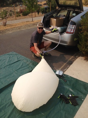
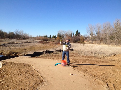
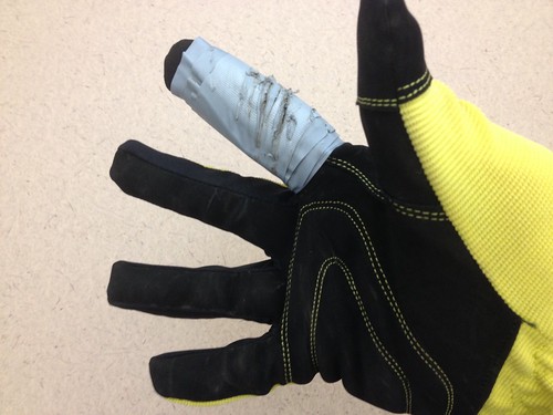
November 3, 2014.  Clear and cool with a light breeze – a perfect morning for field work.  Students from Professor Pittman’s GEOG 331 – Exploring Maps and Geographic Technologies course gathered in the parking lot at the north end of campus for some balloon aerial photography.  Jason explained some of the basics and gave a safety orientation.  Rule #1:  Anyone handling the line must glove up!

Untitled

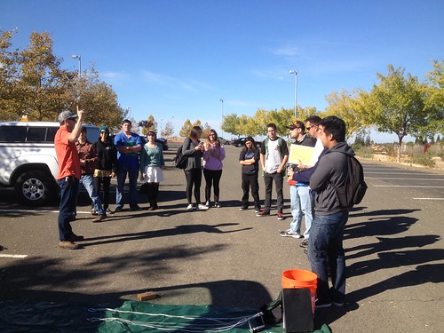
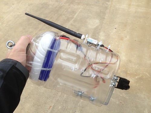
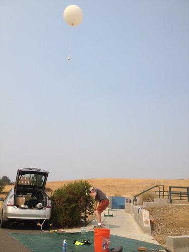
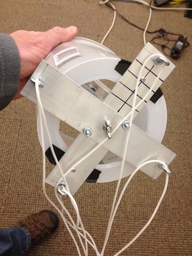
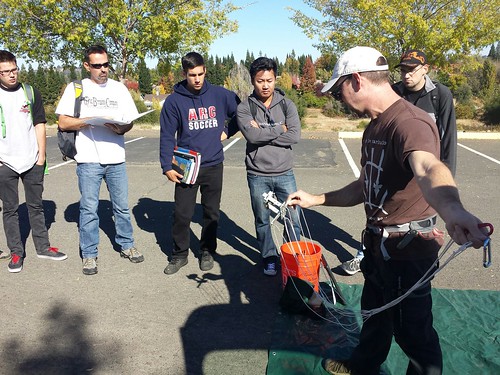
As we filled the balloon, we realized that we had miscalculated the helium required.  The tank wasn’t quite full, and the balloon wouldn’t pull the picavet with the Canon SX130.  Forced to improvise, we clipped a much lighter iPhone rig (running the TimeLapse app) directly to the string attachment point, and we were ready to fly.

Explaining the Picavet

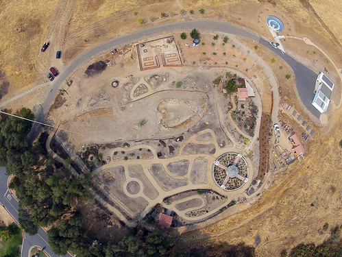
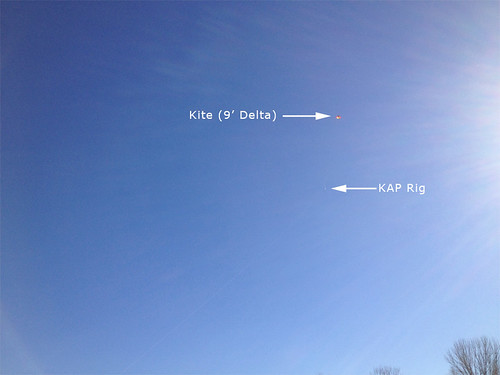
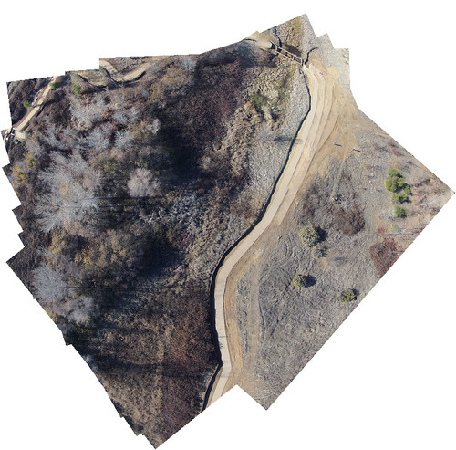
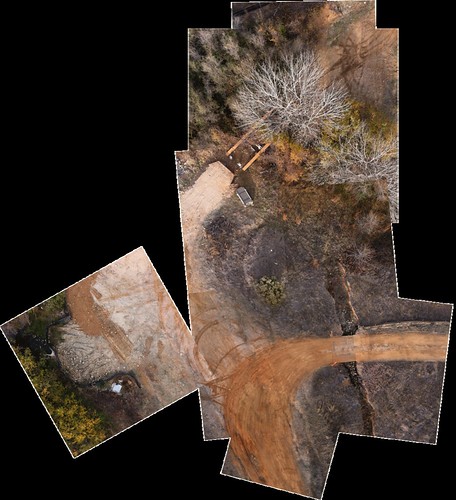
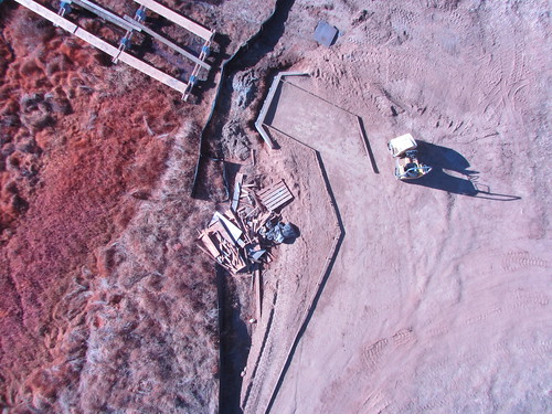
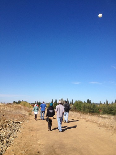
With the lighter camera setup, the balloon flew fine, and students walked the trails that run through the wetlands.

We uploaded the photos to Google Drive, and over the next week, students will use Map Knitter to stitch the photos together and georeference them.

Fall Colors from Overhead

Streaming Balloon Video

For Folsom Lake College’s 10th anniversary celebration, we rigged up the balloon to stream video to a monitor on the ground, using a custom rig with a POV camera, battery, and transmitter, all housed in an apple juice bottle rig.

Apple Juice Bottle Streaming Video Rig

Never having tried the setup before, we launched the balloon, and streamed the video to a little field monitor.  Everything worked perfectly, and on the first try besides!  Children seemed to appreciate the balloon’s eye view of the college.

Untitled

We had to pull the balloon down and hide it from the falcons that were flown once or twice throughout the day.  Apparently balloons are used in training the birds, and we were concerned that they would go after it.

Untitled

After the falcons had finished their flights, we launched the balloon again, now streaming to a much bigger monitor stationed at our table. Once again, things worked exactly as planned.  The video was surprisingly clear and the stream stable, save a few transmission hiccups from time to time.

Untitled

Next steps include building a dual rig, with a camera for still images, and the streaming gear to aid in positioning the balloon. We also need to explore fins or other means of stabilizing the streaming rig, as it got to swinging pretty severely at times. It was attached directly to the string attachment point, so it’s entirely possible that hanging it from a picavet will take care of the swing.

First Balloon Flight

Untitled

With the easing of the helium shortage, we finally acquired a tank or two of the noble gas, and headed up to the El Dorado Center yesterday to launch our new imaging platform. First flights are always a little nerve-wracking, with safety considerations and weather variables and unknowns, but we drafted a protocol, filled the balloon, and sent it up.

Untitled

We had used half the tank the other day on an aborted attempt – the balloon popped – so we ran out of gas a little short of the balloon’s capacity.  While it lifted the picavet, it wasn’t especially enthusiastic about it. We brought it back to the ground, changed the 300# line to 100#, removed the bucket, and sent it back up. These weight tweaks worked well, and the balloon pulled the load gently but definitively.

Release the picavet!

A balloon is quite a different animal than a kite, and flying it took some getting used to. All in all, quite a bit less stressful than kites or quadcopters, as the helium counteracts (most of) the drop-out-of-the-sky, camera crushing effects of gravity. We were able to capture this nice image of the El Dorado County Master Gardeners Demonstration Garden, a work in progress, and one that we can hopefully document over time with additional flights.

Demo Garden from the Air

Overall, a satisfying success.  Next steps include constructing a new, lighter picavet specifically for the balloon, and finalizing the POV streaming rig we plan to fly over the crowd at a college event in October.

Having a Field Day

Puppy in a Backpack
On Friday, April 4th, Jason and I went out to Cronan Ranch Regional Trails Park to do some recon, his new puppy in tow (and eventually in the pack when she tired of hiking).  Though we brought kites, rain and lack of wind kept us out of the air.  We were able to formulate a flight plan for the following Friday, and met a group of students for some hands-on learning.

Students paired up and took to the trails armed with Trimble GPS units, gathering data for the American River Conservancy.

P1013367
After a few hours of trail mapping, the group met at the rendezvous point, and we got out the kites. The maiden voyage of the 12′ delta ended up with the kite atop an oak tree, but a quick climb freed it for another go. Though there seemed to be plenty of wind at ground level, the kite just wouldn’t stay up, so we switched it out for the 9′ delta. Despite valiant efforts by a couple of students, we weren’t able to get up into any stable air, so we didn’t end up with any photos.

P1013404
Despite the unsuccessful flights, students were enthusiastic about the process, and about applying what they’ve learned.  There is no substitute for field work!

P1013371

Picavet Bucket Mod

Bucket Mod

It’s been pretty quiet on the flying front this winter, but we’ve got a field day planned for Cronan Ranch tomorrow, so I took a few minute to mod the picavet.  In the prior incarnation, the bucket was not attached to the picavet cross, but was instead sandwiched between the cross and the camera mount.  As such, every time the camera mount had to be changed, the bucket came with it, making for some annoying alignment issues.

To remedy, I cut away the middle of the top of the bucket (to make camera attachment a little easier, and to make the camera screen visible from outside of the bucket – the camera is always pointed straight down, and without access to the screen it’s sometimes difficult to tell if the camera is firing ), and attached the bucket directly to the picavet cross via two machine screws.  Much better.  Let’s hope the predicted winds arrive tomorrow…

A Pretty Big Kite

A pretty big kite.
New kites arrived. Pictured here is a 12′ Riviera Highlighter from Into the Wind, and we received the double lifter sled 30 as well.  We hope to get some images from above Mormon Island, a local historical mining community.  A very dry winter and the resulting low water levels have exposed parts of the town, the remains of which are typically hidden beneath Folsom Lake.

More KAP Experiments – Photomerge

Nice breeze this afternoon, so I gathered the kite and KAP rig, found a colleague – Kevin Pipkin (Professor, Mathematics and all-around good guy) – and headed down to the wetlands to fly, this time with the GoPro, set to whatever the medium (as opposed to wide) angle setting is called.

Kevin Pipkin at the Helm

Terrific wind, about at what I imagine to be the limit for the 9′ delta, and the kite pulled like a champ.  We gathered quite a few images, and a short video as well.

Kite and KAP Rig

Back at the desk, I thought I’d give Adobe Photoshop’s Photomerge feature a shot, using the “Collage” option.  Here’s the result:

Combined Photos using PShop Photomerge

Though it’s a little sketchy out at the margins, it’s actually not bad for a hands-off process.

iPhone Kite Aerial Photography

iPhone KAP

The weather was pretty good for KAP yesterday, with variable ground level winds somewhere in the 2-5 mph range, so we took the 9′ delta down to the wetlands north of the college to test out the new iPhone rig.  Gathered two hundred or so shots using Timelapse, a very useful app, and worth every penny of the $4.99 asking price. Unfortunately, I misaligned the iPhone within the protective bucket, such that each image contained a bit of the edge of said bucket.  As a result, I had to run a Photoshop action to crop the images, losing a bit of data in the process.  Nevertheless, I was able to stitch together some of the best photos using both Photoshop and MapKnitter, which I’ve mentioned before:

MapKnitter is a free and open source tool for combining and positioning images in geographic space into a composite image map. Known as “orthorectification” or “georectification” to geographers, this step covers the process of figuring out where images can be placed on an existing map, and how they can be combined, or “stitched” together.

With each successful (and unsuccessful) flying session, we’re learning a great deal.  For instance, we’ve added a can of compressed air to the field kit to deal with the inevitable dust that seems to find its way onto the camera, and before the next flight, I’m going to find some sort of ground cloth to use as a relatively clean surface upon which to set up the picavet and rig the camera.  Progress.

NIR KAP!

Flew the 9′ delta this afternoon in the wetlands below the college, and sent the NIR camera up for the first time, resulting in photos that look something like this:

IMG_0057
Lessons learned:

1.  Flying solo is more difficult than flying with a partner.  I had to find a stable elevation for the kite, step on the line, and rig the picavet with one hand.  A few times when the camera was dangerously close to the ground, it would have been nice to have a partner to keep it safe from harm.

2.  Given the way that that camera sits inside the bucket, it’s a little difficult to operate it.  I’m going to noodle on a solution…

3.  Always bring a broad-brimmed hat and/or sunglasses.  I had neither.

4.  Always always wear gloves.  I burned through about eight wraps of duct tape in this one flying session.  I like the overall weight of the glove pictured below, I just need to find a way to add a heavy duty sleeve to that finger.

5.  A 1 minute interval is too long.  I’m thinking that 30 seconds will give more overlap, which will enable better knitting.

Untitled