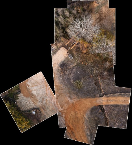
The weather was pretty good for KAP yesterday, with variable ground level winds somewhere in the 2-5 mph range, so we took the 9′ delta down to the wetlands north of the college to test out the new iPhone rig. Gathered two hundred or so shots using Timelapse, a very useful app, and worth every penny of the $4.99 asking price. Unfortunately, I misaligned the iPhone within the protective bucket, such that each image contained a bit of the edge of said bucket. As a result, I had to run a Photoshop action to crop the images, losing a bit of data in the process. Nevertheless, I was able to stitch together some of the best photos using both Photoshop and MapKnitter, which I’ve mentioned before:
MapKnitter is a free and open source tool for combining and positioning images in geographic space into a composite image map. Known as “orthorectification” or “georectification” to geographers, this step covers the process of figuring out where images can be placed on an existing map, and how they can be combined, or “stitched” together.
With each successful (and unsuccessful) flying session, we’re learning a great deal. For instance, we’ve added a can of compressed air to the field kit to deal with the inevitable dust that seems to find its way onto the camera, and before the next flight, I’m going to find some sort of ground cloth to use as a relatively clean surface upon which to set up the picavet and rig the camera. Progress.
[…] had some success using the iPhone for aerial imaging from kites, balloons, and quads, so I’ve been looking for a way to mount […]